 Last week I saw the the Kickstarter project for Wear You Live – prints made with figureground maps of different US cities. We have been blogging about lots of map related things over on BlogLocal and I have been on the hunt for anything map related.
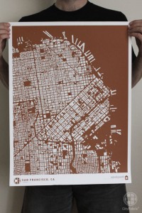
The maps that we use are called figuregrounds. This type of map is commonly used in the fields of city planning, design and architecture to study density and development patterns by depicting all of the buildings in a city as opposed to the streets, parcels or transit lines. Figureground mapping is almost 250 years old and was the first time a city was technically surveyed and portrayed in the 2D, google map view that we commonly use today.
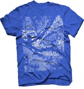
 As soon as I saw these t-shirts, totes, pillows and prints – I thought why not Pittsburgh. I wanted to see how the rivers and the parks of Pittsburgh would show up on a figureground map. So I emailed Matt, the brains behind the Wear You Live project. Matt kindly replied to say he would see what he could do. They were happy that the project had been so successful. Well, it turns out I wasn’t the only one asking about Pittsburgh. Matt emailed me on Friday to say that Pittsburgh was on the way. From his email:
ps, its amazing how many people from PGH have contacted us about adding their city.
Because you asked!
So a few hours ago – CityFabric added Pittsburgh to the Wear You Live series! Check out the shout out for Pittsburgh from their map.

It all started with a t-shirt…
While these shirts aren’t printed in Pittsburgh, I am happy to support this project. Before IheartPGH was a blog, it was a t-shirt – I <3 PGH was the first t-shirt that I learned to screenprint. After a trip to the Warhol museum on a rainy sunday afternoon, I decided I wanted to screenprint. The rest is history and tshirts have been an ongoing theme of this blog. I first met Dan from Commonwealth Press because he had posted a flyer about t-shirt printing and congrats to Dan who has expanded to an even bigger facility since we last wrote about their shop in 2010 . I went on to work for Spreadshirt.com writing their blog about t-shirt printing for 3 years. And it was an article about t-shirt and rust belt cities that landed IheartPGH a mention in the New York Times. The article also profiled STLstyle – a St. Louis t-shirt shop and community cheerleader that has become a good friend of IheartPGH. So local t-shirts have history of bringing people together.
Where to Get Wear You Live Pittsburgh Gear

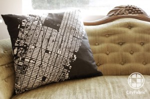
You can now get the Pittsburgh figureground map on a t-shirt, tote, pillow, print or canvass for your wall from the Kickstarter project here. Here are some the items you can get, more are listed on the Kickstarter pager.
- $25 = T-shirt or Tote
- $40 = Unframed Print
- $45 = 2 Totes or Tees
- $61 = Print + Tote or Tee
- $80 = 18″X18″ pillow
- $100 = 5 Totes or Tees
- $100 = 3 prints
- $101 = Pillow + Tote or Tee
- $115 = Pillow + Print
- $4900 = Matt will get a Tattoo of Raleigh, NC on his arm
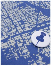
Each item comes with a “pin your place” button so you can mark exactly where you live in Pittsburgh.

