Author Archives: Andrew

About Andrew

Andrew Tsou is a journalism major at Penn State New Kensington; he is currently a senior, and after graduating, he hopes to pursue and obtain an M.F.A. in creative writing.

Keystone State Park

Lake at Keystone State Park (Photo by Andrew)

Keystone State Park, located northeast of Greensburg, can admittedly be a minor hassle to get through for Pittsburgh residents (can we all agree that Rt. 22 is a pain? Thank you.). However, if you’re willing to make the drive, it’s definitely a great way to spend a day off.

Most of the park is built around Keystone Lake; fishing and boating are permitted, and canoes and the like are rented out (check for the building near the northwest corner of the lake). Swimming is permitted in one section of the lake, and indeed, there is an extended lawn near the swimming area, as well as a concession stand and a large playground. This “beach” area tends to be rather crowded in the summer, though, so plan accordingly.

There aren’t many “trails” at Keystone; most of them are located near the Wetlands Observation Area. I suggest parking in the beach parking lot and crossing the street from there, but one can also park in a smaller lot further up the road, a lot that will provide access to the opposite end of the trail system. Admittedly, the trail system is rather confusing, because the intersections don’t coincide with those on the park map, and although the trails are blazed, the blazes are not marked on the map…

Actually, in this instance, I’d argue that simply walking around the lake, on the road and through fields and sidewalks, is a better way of enjoying the park. As odd as it sounds, walking through the campgrounds is rather entertaining; it helps that the Lakeside Trail, which connects the campground to the “smaller lot further up the road” I mentioned earlier, is a really cool, shady walk that’s littered with picnic tables that are great places to, um, picnic, or just to sit and stare mindlessly at the lake.

While you’re in the campground section, with cabins and yurts and all, keep a lookout for the stone lodge, which marks the trailhead for (guesses, anyone?) Stone Lodge Trail. The building itself is neat, for a start, and the trail is one of the better ones at Keystone.

Directions: From Rt. 22, look for Rt. 981 South; there are several ways to turn into the park from here. The most obvious is via Keystone Park Road, but one can also turn onto Flowers Road (which leads to Keystone Park Road); both will be left turns. When I went, a crucial section of Keystone Park Road was closed, necessitating a detour; if the road closures are still in effect when you read this, continue on Rt. 981 until you reach Slag Road (it’ll be on the left, after the parking lot for Loyalhanna Day Use Access). Slag Road will also lead directly into the park, albeit from a different direction; actually, this can be advantageous for first time visitors, because the park office will be the first in-park turn you encounter, so you can stop and pick up some maps if you haven’t already acquired them elsewhere.

From Rt. 30, look for Rt. 981 North; the turning roads will be the same, although they will obviously be right turns instead of lefts.

Also in the area…

The Loyalhanna Lake National Recreation Area is located off of Rt. 981, north of Rt. 22. If you have the time and are so inclined, it’s worth making the effort to visit. Unless you’re planning to fish or picnic, odds are the primary reason for visiting will be to see the dam; depending on your temperament, this will qualify as either worthy and fascinating or appallingly boring. I found it enjoyable enough, but hey, that’s me…

Directions: From Rt. 981 heading north from Rt. 22, look for the signs on your left. You’ll be looking for Bush Road, but it’s easier to look for signs for the park. Don’t be put off by the narrow, twisting road, but then, don’t be in a hurry either. For more details, or simply for your own peace of mind, it might be useful to take along a copy of the area map.
Deer Lakes Park

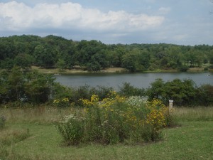
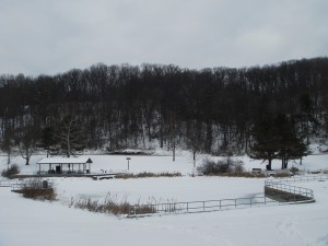
Deer Lakes Park (lower lake) (photo by Andrew)


Like any true Pittsburgher, I love griping about the things that, well, make Pittsburgh Pittsburgh; the topography, the weather, all things Pirates-related, etc. But I also love the variety of parks in the area; in some cases, the drive itself makes the trip worth it. If nothing else, the roads in the Pittsburgh region are always interesting to drive; the same cannot be said for some of our neighboring states (heck, even other regions of Pennsylvania).

The belt system is one of my favorite things about Pittsburgh; it’s not only a great way to find your way around, but following the belt system can introduce you to parts of the region that you were previously unfamiliar with. The orange belt, in particular, passes by a number of parks, including Settlers Cabin Park, North Park, Boyce Park, White Oak Park, Round Hill Park, and Deer Lakes Park.

Of these parks, Deer Lakes is by far my favorite and a must-visit. While most of the other parks are relatively generic, Deer Lakes is a singular getaway place. Low-flying planes are not an uncommon sight, due to the park’s proximity to Rock Airport. Otherwise, there is very little traffic noise, and the park feels as if it has distinct sections and themes, rather than being a mere string of picnic pavilions and playgrounds.

Continue reading

Raccoon Creek State Park

Swimming in Raccoon Lake at Raccoon Creek Stat...
Image via Wikipedia

Raccoon Creek State Park, which is located west of Pittsburgh, near the airport, is worth a visit if you’re ever in the area; there is a swimming area off of the lake, plenty of trails, and simply driving through the park is a relaxing, eminently enjoyable experience.

I didn’t have time to hike all of the trails at Raccoon Creek State Park; it would surely take multiple visits to do so and, particularly at this time of year, I don’t think the city slicking likes of me are up for hiking the entirety of a 9.5 mile trail…but here are a few comments on the trails I did explore.

Continue reading

Riverfront Trails…By Malls

View of the Allegheny River from Chapel Harbor (Photo by Andrew)

One interesting consequence of Pittsburgh’s mad professor topography is the manner in which even the most mundane constructions can be made interesting if they are placed properly. For example, I generally hate malls and outlets, particularly in other cities where the stores are simply a large, ugly mass of commerce placed off of an interstate in a flat, boring tundra somewhere untouched by features that would make for interesting photography.

However, even the more generic malls in the Pittsburgh region (the Waterworks, the Waterfront, the South Side Works) are at least partially redeemed by their proximity to our infamous rivers (note their names). All three offer easy access to trails that border the rivers (and ultimately, these trails are planned to connect outlying areas to the downtown region, which will, with luck, be another step in revitalizing downtown Pittsburgh). These trail systems offer a welcome respite from the teeth-gnashing-inducing frenzy of parking lots and drivers who seem incapable of grasping the concepts of stop signs, pedestrian crosswalks, and the necessity of using one’s headlights, particularly when it is dark outside and one is piloting a black vehicle (or when the grounds are snowy and one’s automobile of choice is painted a well-washed white). Shopping expeditions borne out of necessity (food, clothes, etc) are made slightly less painful when one feels that the experience is not completely divorced from a more pleasant alternative (fresh air, intoxicating views, exercise…).

In general, none of the aforementioned malls offer up any particular surprises in regard to store selection. A familiar array of chain stores is present, although the South Side Works at least adjoins East Carson Street, which boasts a variety of independent stores. The Waterworks, in O’Hara Township, however, is essentially a long string of chains with a few surprises (an Uncle Sam’s Subs, one of only four locations). However, access to a terse riverfront trail is available; the trail can be accessed by parking at Fox Chapel Plaza, a complex adjacent to the Waterworks (or one can simply walk over) and then crossing Freeport Road and walking down Old Freeport Road to the redundantly named Chapel Harbor At The Water. Passing through the at times depressingly monochromatic housing structures (the same style as those found at the Waterfront) leads to one of the best riverside walks I’ve encountered. It’s far enough away from the city proper to be free of annoying traffic or a graceless backdrop of impassive buildings, but close enough to contain trademark views of bridges so close they’re almost touching, as well as a slew of boaters (it doesn’t hurt that the Fox Chapel Yacht Club is nearby). In at least one area, enough trees have been left on the banks of the Allegheny to permit a delightfully innocent view of the river; even the concrete pier/balcony seems less stony when one is actually out near the end and gazing out at the river (the direction probably to be determined by the position of the sun).

The trail at the Waterfront can be accessed from virtually any parking lot on the river’s side of West/East Waterfront Drive. If one is already parked in the “main” section of the mall (where the “town square” is), the trail can be accessed via a pedestrian bridge that crosses over West Waterfront Drive. Although recent property developments on the other side of the Mon have compromised the view somewhat, the trail remains a wonderful, terse walk as a diversion from the bustle and impersonality of the shopping complex proper. For maximum enjoyment, keep your head turned towards the Mon and away from the parking lots and housing developments; in doing so, you might notice people hiking or fishing from a trail on the other side of the river, but access to that trail is a bit iffy, and by the time you’ve crossed the Homestead Bridge towards the city, you probably just want to get home, rather than hang around the heavily trafficked area, but if you must, take a right onto Old Browns Hill Road and follow the road to the parking lot down by the river.

At present, the two aforementioned trails are relatively short affairs, existing unconnected to the rest of the Heritage Trail system, but the trail from the South Side Works already connects to downtown Pittsburgh. The trail’s pretty easy to find; just wander through the South Side Works towards the Mon, and you’re bound to stumble upon it. Granted, this region feels far more industrial than the other two areas (ironic, considering that the Waterfront was once the site of a steel mill), but perhaps no view is as quintessentially Pittsburgh as that of a row of bridges cutting out of hillsides and into tunnels, and, of course, bridges in the downtown region are all but spaced every few blocks, so…enjoy!

The Attic

WASHINGTON - FEBRUARY 25:  This compact=
Image by Getty Images via @daylife

The Attic, a record store in Millvale, presents one argument against the “.mp3s are killing vinyl and CD” mindset.  Upon first entering the store, one is confronted by shelves stuffed with CD’s and singles, crammed into an absurdly tiny space.  From this view, one might conclude that The Attic is a snug store with a decent (ok, impressive) collection.  Of course (and you probably knew this was coming), there are two wings off of the main room; the room on the left contains more CD’s (a lot more, actually), and the room on the right contains ludicrous amounts of vinyl.  You could spend an entire afternoon just exploring one room (take it from me; I have).
Continue reading