Author Archives: Andrew

About Andrew

Andrew Tsou is a journalism major at Penn State New Kensington; he is currently a senior, and after graduating, he hopes to pursue and obtain an M.F.A. in creative writing.

Moraine State Park and McConnell’s Mill State Park

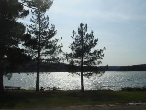
Moraine State Park (Photo by Andrew)

These two parks, located about an hour north of Pittsburgh, are essentially neighbors, but they are completely different experiences. McConnell’s Mill is a rather quiet place, with a playground and a few trails, as well as the mill itself, of course; although the park proper is far larger than it might initially seem, most of its activity is concentrated in one tiny space. Moraine State Park, on the other hand, is a sprawling, expansive park with two distinct sections; in fact, each half (a northern area and a southern portion) could be considered a separate park in its own right. Both sections boast extensive picnicking, swimming, and hiking opportunities.

There are two designated swimming areas at Moraine State Park; between them, the southern beach (“Pleasant Valley”) is far superior, in my opinion. Not only is the permitted swimming area larger at Pleasant Valley, but it tends to be less crowded (!). Although the other beach (“Lakeview”) has more extensive amenities, this is the only edge it has. The view of the lake is better at Pleasant Valley as well; it feels more spacious and attractive than the view at the Lakeview beach does.

Of the various trails at Moraine, two deserve special mention. One, Glacier Ridge, is accessible from various parking areas scattered among the northern section of the park. I suggest parking at the de facto “Glacier Ridge Trailhead,” which is the first parking lot after the bicycle rental building if you’re heading east on North Shore Drive. If need be, you can also park at the bicycle rental building, but that necessitates walking on a portion of the bike trail…and while enjoyable, the bike trail is far too controlled and predictable to be considered preferable to Glacier Ridge. The trail is rather lengthy (14 miles), and although there is a shelter, most hikers will want to simply turn around after a few miles. There aren’t any real sights of note on the part of the trail I’m familiar with; rather, the trail is simply enjoyable for what it is, a meandering path through the woods, with a few cool bridges and views of the lake to offer diversions. Also note that Glacier Ridge is also known as the “North Country Trail” on the map.

The other trail of note is the Sunken Garden Trail, which can be accessed via the parking lot for the Pleasant Valley beach (actually, there’s an earlier parking lot that you can use as well, but if you’re planning on swimming as well, it’s probably best to park closer to the beach and then walk to the trailhead, as opposed to vice-versa). The name of the trail is particularly accurate in this instance; there is an extended section that runs alongside the lake, featuring flowers and other richly colored vegetation that dwarf pedestrians. There are a few cutoffs that lead down to the lake, providing some excellent views of the area. Two ways of hiking the trail exist: a short loop and a longer loop. Because the shorter version of the trail can be walked in as little as forty minutes, this is a great trail to hike if you’re pressed for time.

Although there are trails at McConnell’s Mill, to be honest, none are all that impressive. The Alpha Pass Trail (which heads north from the Mill proper) is probably the best, and there are definitely some cool views of Slippery Rock Creek from the various trails, but to be honest, the best reason to visit is to simply see the Mill. It certainly won’t take you very long to explore the mill, but it’s definitely worth seeing a watermill in “action.” Because Moraine State Park is so close, you don’t have to feel guilty about driving all the way just to see a historic site; you can take a look around McConnell’s Mill for a few minutes, perhaps marvel (?) at the covered bridge, and then drive a few minutes east to Moraine, where better trails and recreational activities await.

Directions (to Moraine State Park): From I-79, there are two exits that will lead to the park (Exit 99 and Exit 96). To access the northern section of the park, take Exit 99; there’ll be signs indicating which road to take. Exit 99 also leads to the southern section of the park, but you’ll have to stay on Rt. 422 for a bit. If you’re coming from the south (i.e., Pittsburgh), I suggest taking Exit 96; make a right onto Rt. 488, and then take a left onto Pleasant Valley Road (don’t worry, there are signs for the park at the turn). This road will lead you directly into the southern section of the park, where Pleasant Valley beach is located.

Directions (To McConnell’s Mill): If you’ve already visited Moraine State Park, all you have to do is get on Rt. 422 west; McConnell’s Mill Road will be on your left. This is the road that leads into the “main” section of the park. If you decide to visit McConnell’s Mill first, take Exit 99 off of I-79 and turn left on Rt. 422; again, the turn will be on your left.
Prince Gallitzin State Park

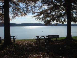
Lake at Prince Gallitzin (Photo by Andrew)

Prince Gallitzin State Park, located in Cambria County, is not the easiest state park to access, which lends it a remote charm. That said, when I visited last summer, the campground was rather crowded (though not overwhelmingly so), all of the best parking spots in the fishing areas were taken, and the lake was populated with a healthy number of boaters, so it’s no ghost town during the peak season.

Returning to the park more recently, in the off-season, the situation was rather different; boaters were now the exception, and aside from the marina, most of the parking lots were all but vacant. The beach was closed, of course, and there were but a handful of anglers.

There are two views of the lake that are worth making a special effort to visit; one is located off of SR 1026, and if you’re heading east, it will be located on the left. There are two entrances and they’re well-marked, but if you happen to miss it, the ranger station is just down the road, and you can turn around there. This first vista, called Mud Lick Overlook after the section of Glendale Lake it is nearest to, contains a pavilion that makes for a great inclusion in a photograph, if such structures are fitting to your artistic sensibilities.

The second vista, amusingly titled Headache Hill Overlook, can be accessed en route to the west end of the lake (more on this later, but the road is called Beaver Valley Road and marked with signs that indicate that it is a relatively minor section of the park, but don’t be fooled: the best trails are in the west area). From Beaver Valley Road, make a right at the four-way intersection onto Long Road and bear left at the hill up to the structure that looks like a water tower. The tower can be climbed via a set of stairs, and it offers what appears to be a view of two lakes, but it’s actually the same lake (the connecting canal is hidden from view).

The eastern section of the park is where the main beach is (there is a beach in the western section, but you have to be staying at the campground to use it, unless you want to walk a significant distance on a dirt trail in your swimming gear). It is also the site of a number of gentle, entertaining trails. To access this area, turn onto Buck Road from SR 1026 (don’t worry; it’s well marked). All of the beach parking lots are ultimately fairly close together, but the lot for Beach #3, at the end of Buck Road, is probably the “best,” in terms of design and lack of crowds. This lot is also where one would start on Turkey Ridge Trail or Huges Trail, which are worth your time. Also of interest is Lakeshore Trail; this trail begins directly below the parking lot for Beach #1, but if you’re parked at Beach #3, it’s silly to move your car. Instead, simply walk down to the beach and head south (with the lake on your right) until you reach the trail. The view is arguably better from the beach anyway, and you’re saving gasoline.

The western section of the park contained the trails I enjoyed the most. The best place to park would probably be at the Point Trailhead, but one can also use the visitor parking section of the campground (turn at the campground entrance and follow the signs). The Point Trail itself is a delightful hike that passes through a cool swamp and runs along Glendale Lake for a significant length. It’s about three miles long, but it’s also one of those trails that doesn’t seem that lengthy due to the sheer enjoyment of the views it provides. One can also hike the Campground Trail, which connects at both ends to the Point Trail; exploring the section that runs along the lake is definitely worth your while. This section of the Campground Trail will lead you to the western shore beach, as well as by the Camp Store, which might be useful if you need a quick snack.

Even if you’re not into fishing, stopping at some of the fishing areas is worth the time; the different perspectives of the lake are always a pleasure, and there are at least two that have unique features that might be of interest to photographers and general sightseers. The Beaver Valley Marina contains a cool little peninsula that seems to place you in the middle of the lake, and the Pickerel Pond area contains a neat little fishing pier and another bridge further back that permits one to construct a mini-walking loop. The trees in this area are also great for photographs.

Directions: Well, the bad news is that there really isn’t an easy way to access the park, and even from Pittsburgh there are two distinct routes to Prince Gallitzin. This map might be useful, but consulting a Pennsylvania map would definitely be advised. The route I took involved following Rt. 28 north to Kittanning and then following US-422 east, but from there, the optimal route gets somewhat complicated…a route that’s easier to summarize (but longer) involves making your way to Monroeville, following Rt. 22 east, and then taking Rt. 53 north (per the map provided earlier).

Presque Isle State Park

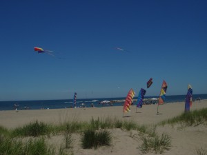
Beach at Presque Isle (Photo by Andrew)

Ok, Erie is hardly the most obscure selection for a day or weekend trip from Pittsburgh, but it deserves a mention here, if only as a reminder, because Presque Isle State Park is simply one of Pennsylvania’s most enjoyable state parks and one of the best ways to spend a Saturday off.

One of the factors that paradoxically makes Presque Isle so magnetic is its proximity to the industrialized downtown Erie; driving to Presque Isle necessitates navigating a series of unattractive highways and strip malls, and so arriving at the park itself makes its natural charm that much more evident and appreciated.

There are no less than eleven (!) beaches (i.e., designated swimming areas) at Presque Isle, and there are plenty more areas where, although swimming isn’t permitted, you can walk along the lakeshore. A large playground and a bike/surrey rental shop can be found about halfway into the park, and yes, surreys are a common sight at Presque Isle. Also notable are a number of fishing facilities; although I don’t fish, I got a kick out of walking along the dock at the North Pier; the North Pier also has a view of Gull Point (more on that later).

One of the nicest features of Presque Isle is the existence of the Karl Boyes Multi-purpose National Recreation Trail. This trail circles virtually the entire length of the island, and it is handicapped accessible. The trail manages to run along the main road through the park, so the good news is that you can basically park wherever you find a spot and pick up the trail from there.

Admittedly, the trail is best suited for bikers, and the proximity of the road is predictably just as much a nuisance as it is a perk. Luckily, there are a number of alternate trails in the park. My favorite is Gull Point Trail, which can be accessed via the parking lot for Beach #10 (AKA Budny Beach). The vegetation on this trail is certainly unique, and being no botanist, I can’t hope to describe it with any scientific accuracy; the best I can do is to say is that, in many places, it feels like walking through a narrow corridor whose walls are weeds (just trust me on this one). Gull Point Trail’s name suggests some sort of observation point along the way, and there is indeed one, at the end of the trail; it’s an actual observation platform that one can climb up to get a great view of, well, Gull Point. Yes, this name is accurate too, at least when I went; the coasts were amazingly densely populated by (presumably) gulls.

A note on this area: the map (and signs near the end of the trail) indicate that the area is closed between the beginning of April and the end of November. This attempt at freeing the area from any human presence notwithstanding, the trail itself is open year-round, as long as one doesn’t diverge from the marked path (and you really shouldn’t be doing that anyway, but human nature being what it is, you never know).

The other trails at Presque Isle are decent enough, but somewhat unremarkable. The most memorable is the Sidewalk Trail (yes, it boasts something of a sidewalk running down its length). In all honesty, it’s memorable because it’s basically a straight path for an absurdly long distance; on the map, it’s shown as a straight line for 95% of its distance, and that’s what it is. If nothing else, though, it’s a useful lesson in depth perception, both to the eyes and to a camera lens.

The Presque Isle Lighthouse & Exhibit might be interesting if you’re a lighthouse person, but to be honest, the views of the lighthouse aren’t all that great. That said, the beach around the lighthouse area is one of the best in the park, in my opinion, in terms of both the view and relative lack of crowds.

Also in the area…

Waldameer Park & Water World, as its name suggests, comprises elements of both a waterpark and a more traditional amusement park. En route to Presque Isle, you simply can’t miss the park; the Ravine Flyer II, its signature roller coaster, actually cuts across the main street. It’s a sight to behold, even if you don’t intend to ride it. This year, the park will be open as early as the first weekend of May, albeit with limited hours and the waterpark section closed. For full details, please consult the park calendar. Note that Waldameer is closed on most Mondays.

Across the street from Waldameer is the Tom Ridge Environmental Center, which is a definite must-visit if you have grade-school-age kids. I’d say it could be called a less elaborate version of the Carnegie Science Center, but there are some really neat exhibits that are definitely worth checking out. For example, there are a series of Adirondack chairs that are made out of recycled materials and are surprisingly comfortable. Conservation is the major theme here, as one would expect from the name of the place. Even if you aren’t interested in the exhibits, there’s a cool observation deck that overlooks Lake Erie and provides an interesting angle from which to view the roller coaster.

Directions: From Pittsburgh, basically all you have to do is follow I-79 north; the road will basically end in Erie. Follow the signs for Presque Isle (the road will be Rt. 5 West). Note that, somewhat frustratingly, the turn for Presque Isle is NOT MARKED. You’ll want to make a right onto Rt. 832, which basically leads directly to the park.

Beechwood Farms/Todd Sanctuary

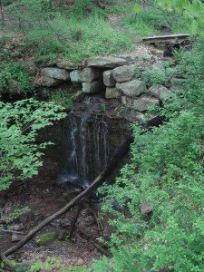
Waterfall at Beachwood Farms, as seen from Pine Hollow Trail (Photo by Andrew)

The Audubon Society of Western Pennsylvania has its headquarters at Beechwood Farms, off of Dorseyville Road. Beechwood Farms is probably best known for its annual Apple Jam, which usually occurs in September. The Apple Jam is basically a fall festival geared towards kids, with all the usual activities; face painting, hay rides, etc. Although I haven’t attended in recent years, I have fond memories of the Apple Jam from when I was very young, and if the intense traffic in the area during each year’s Apple Jam is any indication, the quality has not suffered since then.

Continue reading

Trillium Trail & Salamander Park

Trillium Trail (Photo by Andrew)

The trails themselves might be officially dubbed “Xen’s Trail,” “Upper Trail,” and “Falls Trail,” but locals refer to the collective nature area off of Squaw Run Road as “Trillium Trail,” and indeed, maps recently posted at the site are headed with the moniker “Trillium Trail.” There are two parking lots available; both provide access to the ends of Xen’s Trail, so neither lot is inherently preferable; it all depends on how crowded they are (and apart from, say, the first few days of warm weather in March, the lots are rarely so crowded as to preclude finding a spot).

Xen’s Trail is the “main” trail, a level walk beneath a gentle hillside. The trail crosses a creek multiple times; this used to be more of a problem, particularly during rainy months, but recent redirections of the trail and new stepping stones placed in the creek have made this a relatively painless procedure. Be aware, though, that crossing will still be difficult when the creek is particularly high, and unfortunately, the stepping stones (particularly beneath the stairs across the street from the larger parking lot) do not offer optimal traction. This aside, Xen’s Trail is a very easy and relaxing trail.

Continue reading