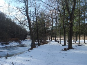
One of the great things about the outlying Pittsburgh areas is the plethora of township parks that are more than just a dilapidated playground and a pavilion with a few well-worn picnic tables. So many parks in this region feature unique structures or landforms, not to mention neat trails…
Emmerling Community Park is one of these parks; the “main” section is attractive on its own, with visually appealing picnic shelters, gorgeously spacious fields, and wonderful landscaping. The park is located very close to Rt. 910, but there is surprisingly little traffic noise. The restrooms are seasonally open and very well maintained. Actually, the only real complaint one can make regards the lack of water fountains (I’ve only found one, and it only seems to be in operation during the summer; it’s all but hidden on the side of the restrooms facing the creek).
As great as the amenities at Emmerling are, unless you have frequent picnics or baseball/soccer games, they’re unlikely to keep you coming back on their own. That’s up to the trail, which can be, depending on how you choose to follow it, a leisurely stroll along a docile stream or a more adventurous trek through the wilderness.
To find the trail, all you really need to do is cut through the fields and make your way to the creek; the path will be self-evident. If you want to begin in a more traditional fashion, look for the double yellow blaze at the far end of the parking lot; there is also a blaze on the footbridge across the creek, but the one near the baseball field is the one you want to follow (the footbridge simply leads to a handicapped parking area and the main road). The path leads along the creek, which is made more impressive by the massive rocky cliffside that borders it on the opposing shore. The Indiana Township website claims that the creek is named “Little Deer Creek,” but a sign by the actual creek simply titles it “Deer Creek.” Regardless of the name, compared to other creeks in the area, it is far more lively and interesting.
There are a few wooden benches along this section of the trail. These benches, unlike many such fixtures, are actually rather comfortable, and they make for excellent places to take a book and spend a few hours reading. The only drawback is that the trail passes very close to one of the baseball fields, which can be annoying if there’s a game in progress.
At one point, the path will cross a bridge over the creek, and the blazes will indicate that the path continues up a ridiculously steep hillside. If you feel up for this climb (it’s actually pretty short, just very, very steep for that short distance), I’d highly recommend continuing on the trail. After the initial ascent, the majority of the trail is relatively level, with only a few minor elevation changes. Following the yellow blazes will ultimately lead you to a road, but from here, you can actually cross the street and continue on the trail. I didn’t follow the trail long enough to see where it ended, but I can say that what I did explore was well worth hiking.
In both sections, there’s also a network of other trails that can be explored. As with Blue Run Trail, composing one’s own map would be advisable. There is only one other blazed trail that I’ve found, this one with green markings. There are a number of shortcut and alternate trails (including some that are absurdly short) that are highly enjoyable to explore. The features of the area are always surprising; there are evergreen groves, something of a swamp, and deep ruts. At one point, I found myself in a bizarre clearing that seemed a cross between a sparsely used junkyard and a wildflower meadow.
However, this atmosphere might not be for everyone. There is an alternative to following the yellow trail all the way; after crossing the footbridge, rather than following the yellow blaze up the hill, follow the unmarked trail by the shelter; it’ll lead along the creek for a decent amount of time, finally terminating by basically leading into the creek. This trail is well-trampled, and so the lack of blazes shouldn’t be a problem. It’s worth noting that there are several points along this trail that provide access to the upper network of trails described earlier (there is even a green arrow pointing the access trail to the green blazed trail). However, all of these access points are as steep as the yellow blazed climb, and most are a good deal longer, and so they probably won’t be of much use to most hikers.
Directions: Emmerling Community Park is located directly off of Cove Run Road, which can be accessed via Rt. 910. Heading east on 910, the turn will come after the intersection of Saxonburg Boulevard; look for a left turn. It’ll be before Emmerling Plaza, so if you pass the plaza, find a place to turn around. Accordingly, if you’re heading west on 910, the turn will be on the right after Emmerling Plaza. Coming from downtown Pittsburgh, the best way to access 910 would probably be to follow Rt. 28 and take the Harmerville exit. Make a left turn at the traffic signal, and stay to the left; this will be west 910.

Pingback: The Trail Of The Green