Until recently, the sign naming “Blue Run Trail” at the entrance wasn’t even there; I only remembered the area being called that from visiting in the 90’s. The Indiana Township website and municipal building simply didn’t seem to have any information about the trail, and until I visited the area the other day to write this article, I was planning to introduce it with an extended musing on the motives for not even bestowing upon the area an official name. I’m happy to report that a (rather weathered-looking) sign now graces the trailhead and makes locating the trail slightly easier (and will hopefully attract more visitors).
While finding my way through the complex trails network for the first time, I found it useful and entertaining to sketch something of a rough map of the area, showing the various intersections and indicating the path I took. The woods are probably not all that large, and the existence of nearby roads, structures, and the creek make for useful landmarks, but there are a number of shortcut trails that can make the area seem more confusing than it really is.
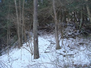
The first section of the area is rather straightforward. Near the parking lot, there will be a gap in the weeds; this is a trail that leads down a set of stone steps, with a wooden deck near the midway point. At the bottom of the hill, you’ll be next to the creek and at an intersection.
During most seasons, the creek isn’t the easiest to cross (unless you have waterproof boots); it’ll necessitate using stepping stones that may or may not be slippery in the extreme. When I went in the winter, the place where one would cross the creek was all but dried up, making crossing a breeze, although caution should still be exercised; at other points, the creek appeared severely icy.
In any case, I’d suggest making a left once reaching the bottom; it’s an easier way to access the best trails, and besides, the best crossing point can be found in that direction. The trail will basically lead straight into a section of the creek rife with large stones that can be (carefully) used to make one’s way across. From here, there are two options; simply following the level section of the trail will lead to an agreeable enough but ultimately slightly dull walk. Instead, try climbing the stone stairs (although there are three stone steps immediately after the creek crossing, the ones I’m talking about are a bit further on; follow the flat trail for a short distance).
The stairs will lead into an evergreen grove that’s a great place to simply stop and look around. At the top of the hill (you’ll know it by the bench), there’ll be a three-way intersection; from there, it’s really up to your individual exploratory spirit as to which way to go. It’s difficult to point out specific areas to seek out from this point, because the system I use to indicate trails is certainly not universal; not only do I use specific fallen trees as landmarks, the paths that I consider legitimate intersections might not appear so to other people…and that’s both the beauty and the frustration of this trail system. It’s difficult to explain specific routes to other people, but the routes you discover and memorize are yours. It’s a way to explore without needing to travel to remote locations or to blaze your own trails through rough vegetation. By combining the various trails in different orders, you can effectively create your own paths…and because there’s no “official” route, there’s not even the suspicion in the back of your mind that you might be doing it the wrong way.
Directions: Blue Run Trail is located behind Dorseyville Middle School; park near the woods between the middle school and Hartwood Elementary School and look for the sign for Blue Run Trail; it’ll be near a gap in the weeds and the guard rail.


Wow – I had no idea this train existed. Thanks so much for posting the info.